


Built in 241 B.C. the Amerina road was the main way of communication from Rome to Umbria region where it reached the city of Amelia. In the Middle Age it had a strategic role, above all during Longobards invasion. Up till now its path is clearly visible in different part of Nepi's territory. Archaeological excavations showed in different points the road whole pavement in some places it is surrounded by different kind of cave tombs.
The ancient Amerina road connected Rome with Umbria region arriving in Ameria, now called Amelia, the city which gave it the name. The path detached from ancient Cassia road near a place called Vacanas, inside the Baccano Valley, and through Nepet (Nepi), Falerii Novi, Castellum Amerinum it reached Ameria. The total distance from Rome to Ameria was of 56 miles as remainded by Cicero in its own oration “Pro Roscio Amerino”.
The road was built in 241 b.C., when the city of Falerii Veteres was destroyed, the most important center of Falisci people, and the roman city of Falerii Novi was founded.
During the roman age the Amerina road was the main path for the local traffic and had the important function to connect the Cassia road and the Flaminia once. It also had a strategic role during the Middle Age when our territory was inveded by Longobards. The control of its path insured the connection between Rome and Ravenna.
In 1787 it was substituted by a modern road between the cities of Nepi and Civita Castellana. The road was modified or erased after some great transformations of our rural landscape in the last two centuries.
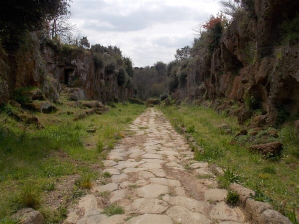
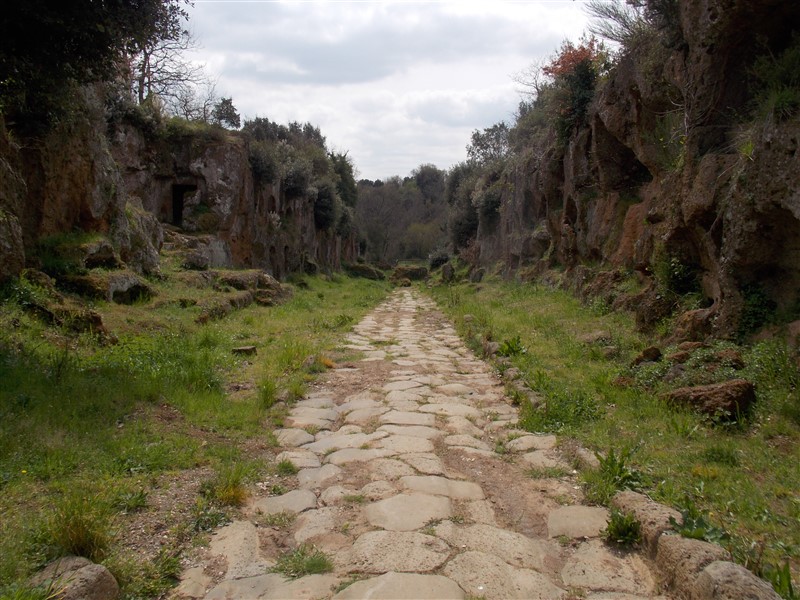
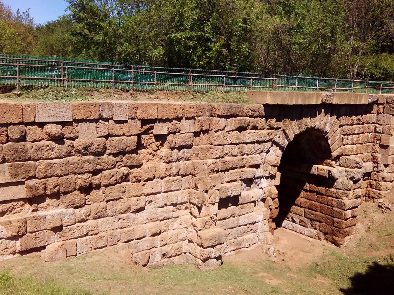
Today its path is still clearly visible in different parts of Nepi’s territory. Near the borders with the cities of Castel Sant’Elia, Civita Castellana and Fabrica di Roma, in a place known as “Tre Ponti” the road enters in a wide stone cut and through different terrain levels with the help of stone bridges it ends in cultivated fields before reaching the walls of Falerii Novi.

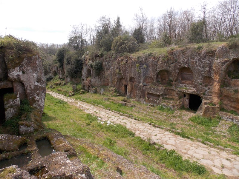
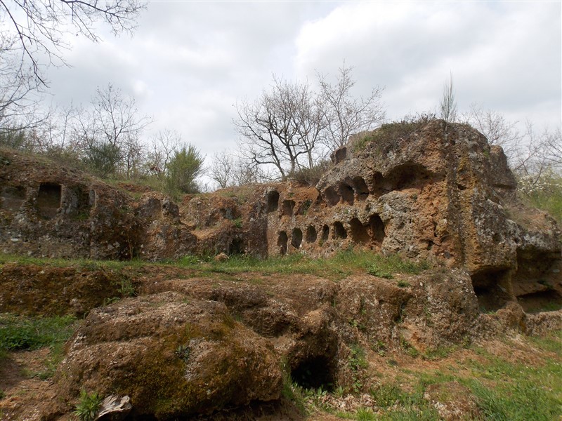
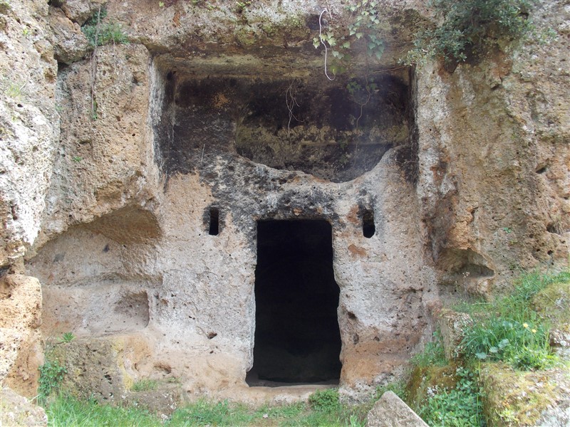
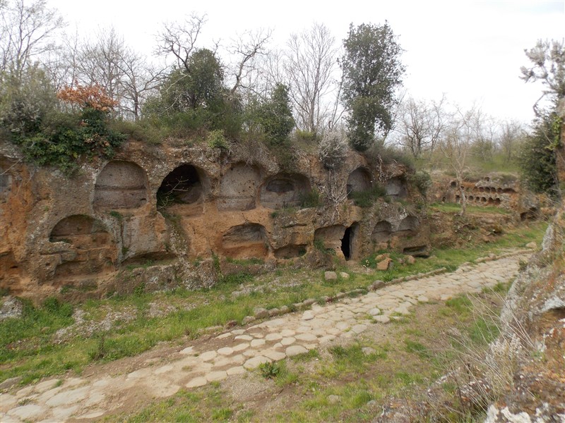
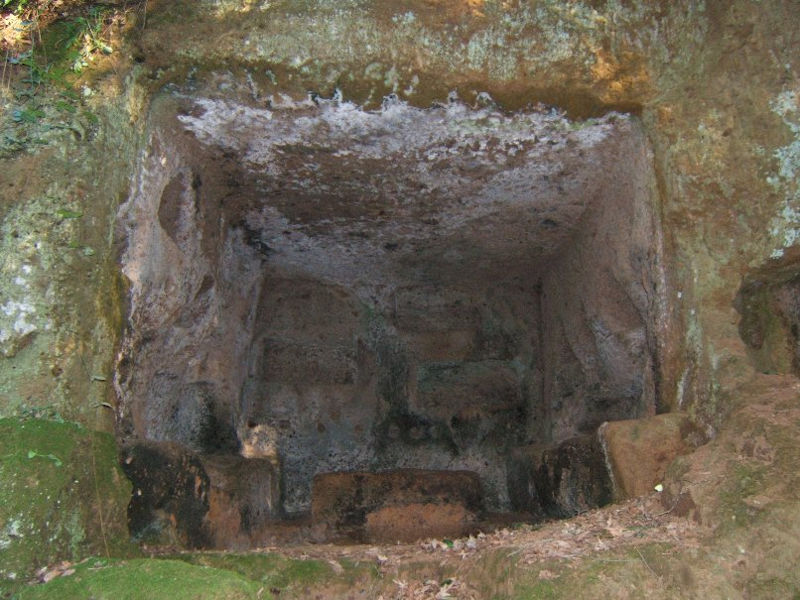
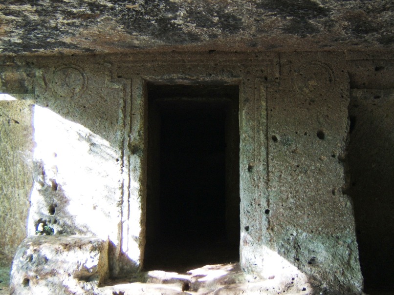
This is for sure one of its best part, characterized by important archaeological evidences located within an uncontaminated environment and the ecosystem of the so called “forre” (canyons). Archaeological excavations have brought to light in several places the intact pavement of the road which is flanked by cave tombs of various types (arcosolium tombs, chamber tombs, pit tombs, etc.) datable to mostly between the 1st century b.C. and the 2nd a.D.
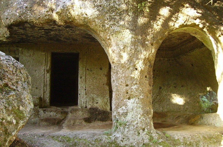
The oldest and most monumental are the so called portico tombs, such as the one called “Queen’s Tomb”, located in a short distance from the area known as “Cavo degli Zucchi”. It is a type of burial characterized by the presence of a “portico” that precedes the funeral chamber and which has its origin in the Etruscan world, as documented by the most significant examples inside the necropolises of San Giuliano and Norchia.
Information
- Address
- Località Tre Ponti
- Ticket
- Free entrance